Pickable reads BC's forest, wildfire and rain records and gives every mushroom spot within your drive one call: Go, Maybe or Wait. It checks parks, reserves and private land, and gets you back to the truck with no signal.
Coming to Google Play first, iPhone after. Calls, maps and the way back to your car are free.
Every spot ends in one of these. Each has its own colour and its own pattern, so you can tell them apart in glare or with colour blindness. Spots within about a three-hour drive come first, best call first.


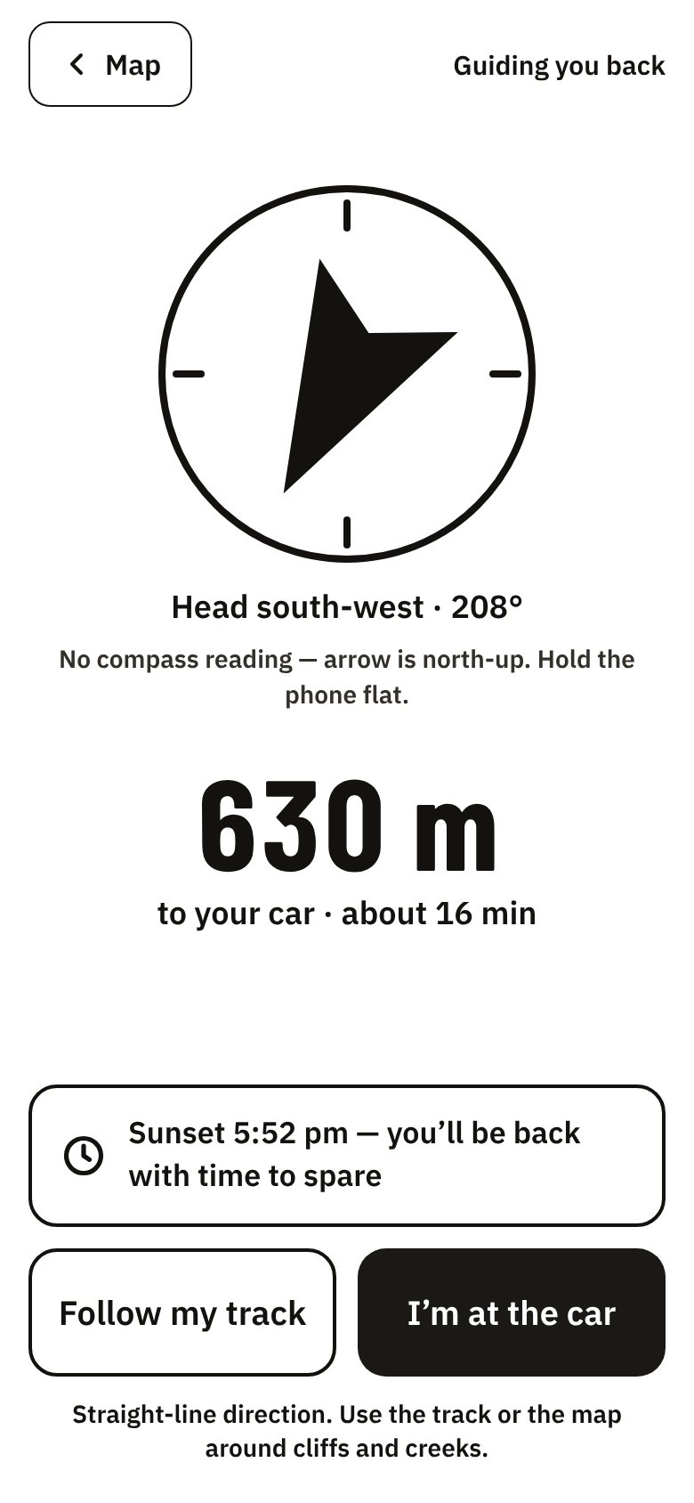
Mark your car before you walk away. Field mode records your track with the screen off, marks each find with GPS, and points you back to the truck with a big arrow and the distance.
It knows when the light goes: it tells you when to leave so you're back before sunset, and can text your plan to someone at home.
The buttons are big enough for wet hands and gloves, and the screen stays light and high-contrast in the sun. Ending a trip takes a press and hold, so a pocket can't end it.
Forest, season, weather and access, checked together for each spot. Each area page shows the numbers behind its call and where they come from.

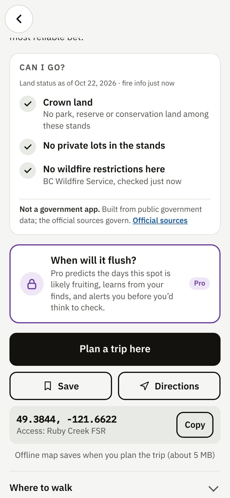
Most BC Crown land is open to picking without a permit. Parks, ecological reserves, reserve land and conservation lands aren't, and private land needs permission. Every area shows a Can I go? card with what applies.
Plan a trip and the offline map saves itself, you get a be-back-by time from sunset, and road notes for the forest service road in.

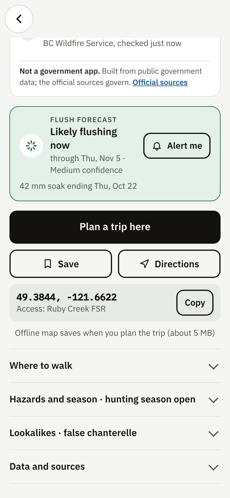
Flush forecast estimates the days a spot is likely fruiting, from the soaking rain and the temperatures since. For saved spots it uses measured rain from Environment and Climate Change Canada, and it learns from your own finds.
Flush alerts tell you before a saved spot is likely to start, so you're not checking every evening.
Unlimited offline maps for every area you plan to walk.
Calls, maps, field mode and the way back to your car stay free. Subscriptions are billed through Google Play and renew until you cancel.

Foragers guard their patches and their health. So does the app.
Nothing in Pickable says a mushroom is safe to eat. Lookalikes are listed for every species. Never eat a wild mushroom on an app's or a photo's say-so.
Trips, finds and photos live on your phone. No account, no public map of anyone's patch. Only Pro server alerts send the spots you watch, and only to alert you.
Parks, reserves and wildfire closures are never a Go. A clear check isn't a legal guarantee, so it says what to verify.
No. It means the forest, the season, the recent rain and the access all line up. Mushrooms still keep their own schedule, and you're responsible for closures, land ownership and what you see on the ground.
BC's forest inventory, BC Wildfire Service fire perimeters and area restrictions, parks, reserves and ParcelMap BC, Open-Meteo weather and Environment and Climate Change Canada rain analysis. See Data sources.
Only to download your region and refresh the weather. Calls, saved maps, field mode and Back to car run on your phone. The app tells you how old its weather is.
No. Drive times use your location on your phone only. Weather is fetched for each area's own coordinates, not yours. With Pro alerts, only the spots you save go to our alert server. See the Privacy Policy.
Google Play comes first and the iPhone version follows. Join the early access list and pick iPhone, and we'll tell you when it's ready.
10ten Studio Inc., an independent studio in Vancouver, BC, which also makes Huntable and Fishable. We forage as a family, and our trips were more miss than hit, so we built the app we wanted.

Pick your weekend from home, and find your way back from the bush. Get Pickable early on Android.
Get early access